India's First Engineering Intelligence Company

Geospatial Mapping

Precision Data Capture & Intelligence

Advanced drone surveys, LiDAR mapping, and photogrammetry delivering survey-grade geospatial intelligence for infrastructure planning and monitoring.

±5mm Survey Precision High-Density Point Clouds Real-time Processing
Request Demo
AI Mines Analytics

Turning Vision into
Verified Reality

Real-Time Mine Intelligence

AI-powered aerial intelligence for defence, infrastructure, and environmental monitoring from drone to decision in real time.

120+ AI Models 98.2% Accuracy Live Dashboard
Request Demo
IWLARS Platform

Intelligent Wagon
Load Analysis

LiDAR-Powered Stability Intelligence

Pulley-guided LiDAR trolley system for automated wagon load scanning 3D point cloud capture, weight distribution heatmaps, and derailment risk assessment.

1.2M+ pts/sec ±5mm Accuracy Auto-Report
Request Demo
What We Do

Built on
Precision,
Proven at Scale

Aerovania's engineering stack spans every layer — from LiDAR survey to AI dashboard — deployed across India's mines, railways, highways and defence corridors.

±5mm Geospatial Mapping
120+ AI Models
100% Indigenous UAV
<200ms Edge AI
2K+ Sq km surveyed
20+ Gov clients
25+ States covered
100% ISO certified
WHY AEROVANIA

Metrics that prove our engineering edge

From DPIIT-recognised R&D labs in Nagpur to live AI deployments with Coal India — every number below reflects a real project, a real client, and a real outcome delivered with zero safety incidents.

View Case Studies →
Sq. Km surveyed across India2000+
Drone survey - RGB/LiDAR/Thermal · DGPS · Bathymetry · GIS
Government & PSU clients20+
Indian Railways · NHAI · NHIDCL · Coal India · NTPC · NHPC · GSI · HAL
LiDAR precision accuracy±5mm
Consistently achieved under controlled survey conditions with ground control
Pan-India operational states25+
Mountains · mines · forests · highways — from Himalayan corridors to coastal belts
ISO-certified quality operations100%
Zero safety incidents maintained across every project delivered to date
Core technology service verticals6
Drone Survey · AI · Edge Computing · UAV Dev · Infrastructure Monitoring · Training

Our Platforms

Platforms Built for
Real-World Operations.

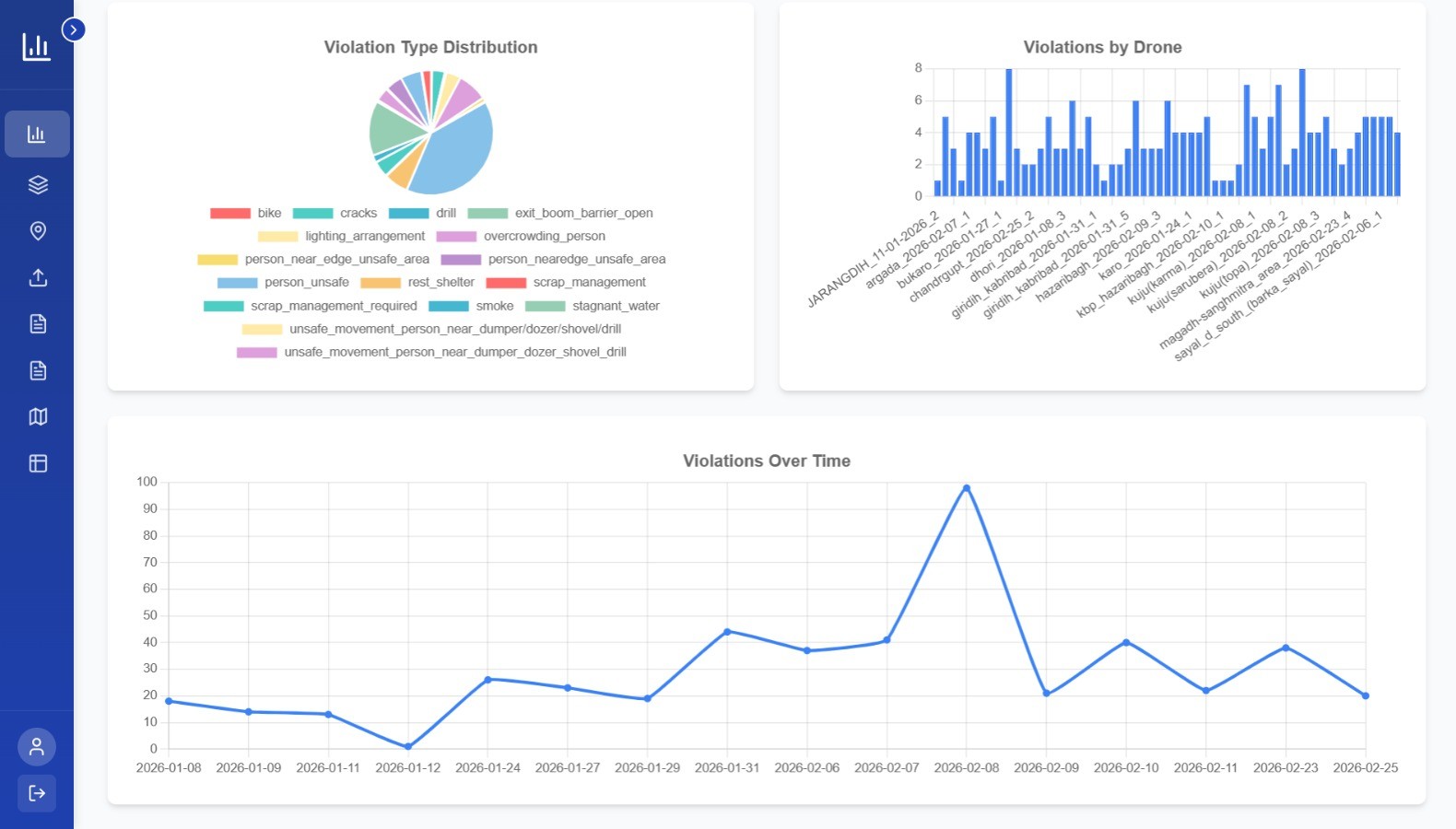
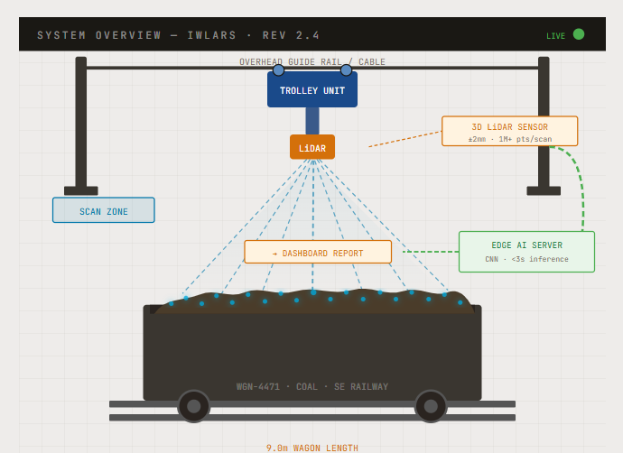
From mine compliance to railway load analysis — purpose-built intelligence for India's critical infrastructure.

Platform 01

AI Driven Aerial Monitoring & Analytics

A comprehensive AI-powered analytics platform for mine operations — real-time violation detection, geospatial site intelligence, video surveillance, and role-based access control.

  • Live KPIs, violation statistics & trend charts
  • Interactive geospatial map with violation markers
  • Detects 23+ mine safety violations in real time
  • Role-based access & ATR document management
120+ AI Models 98.2% Accuracy Real-time
Explore Platform →
AI Mines Analytics Dashboard
Platform 02

IWLARS — Intelligent Wagon Load Analysis & Reporting System

Pulley-guided LiDAR trolley system for automated wagon load scanning — 3D point cloud capture, weight distribution heatmaps, and derailment risk assessment in real time.

  • LiDAR point cloud capture at 20Hz rotation
  • 3D weight distribution heatmap per wagon
  • Centre-of-gravity & derailment risk index
  • Automated engineer stability report generation
1.2M pts/sec ±5mm accuracy Auto-report
Explore IWLARS →
IWLARS LiDAR Platform

Industries we serve

Precision aerial intelligence across India's critical sectors — government-trusted, mission-proven

Railways
Railways
Corridor surveys, Track Alignment, ESP, LiDAR wagon load analysis, Bridge inspection and Track condition assessment
LiDARCorridor SurveyBridge InspectionTrack Assessment
Mining
Mining
IBM compliant Drone survey, Pit progression mapping, Stockpile calculations and AI-powered compliance monitoring.
Stockpile VolumePit MappingAI ComplianceDGPS
Highways
Highways
Topographic Aerial surveys, Construction progress monitoring, and highway corridor mapping.
Corridor MappingProgress MonitoringTopographic Survey
Energy
Energy & Power
Inspection of Power Transmission line · Solar Field · Wind Turbine and Hydroelectric project monitoring
Transmission InspectionSolar & WindLiDAR
Defence
Defence & Security
Land Boundary assessment, Border Security, Loitering Munitions, Intelligence Surveillance and Reconnaissance
Boundary MappingISRBorder SecurityDPIIT
Forestry
Forestry & Environment
Vegetation mapping, forest boundary delineation, canopy analysis, and wildlife habitat assessment and conservation
Canopy AnalysisVegetation MappingHabitat AssessmentUAV
Infrastructure
Smart cities & Urban Planning
Urban 3D mapping, infrastructure asset inventory and smart city planning with high-resolution aerial surveys.
3D MappingAsset InventoryUrban PlanningDTM
Water Resources
Oil & Gas
Pipeline surveys, reservoir volumetrics, and refinery inspection using thermal & LiDAR drones.
Pipeline SurveyReservoir VolumetricsThermal InspectionLiDAR

Trusted By Industry Leaders

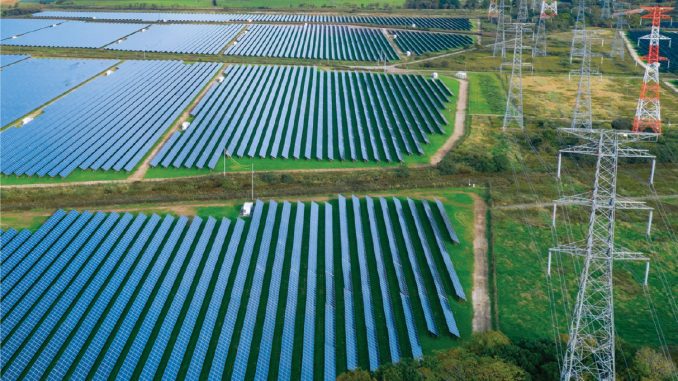
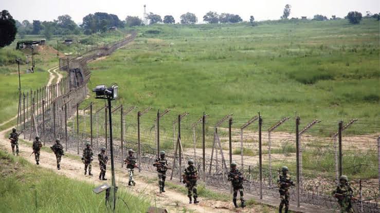
Government bodies, PSUs, and enterprises across India

Client
Client
Client
Client
Client
Client
Client
Client
Client
Client
Client
Client
Client
Client
Western Coalfields Limited

"Aerovania's drone and AI monitoring solutions have significantly improved infrastructure monitoring and operational efficiency."

Infrastructure Development Authority
Government Infrastructure Body

"The real-time aerial intelligence platform cut our site inspection time by over 60%. What used to take days now takes hours — with far greater accuracy."

Head of Operations
Leading Mining Corporation, Jharkhand

"Aerovania's LiDAR and geospatial mapping gave us corridor intelligence we simply couldn't get any other way. The 3D terrain models are exceptional."

Chief Engineer
National Railway Infrastructure Project

"Deploying Aerovania's AI surveillance system across our border corridor transformed our situational awareness. The all-weather capability is a game changer."

Director, Border Security Division
Defence & Security Agency

Let's Build the Future of
Infrastructure Intelligence

Discover how Aerovania's AI-powered monitoring and drones can transform your operations.

Aerovania
Contact Us