Vegetation mapping, forest boundary delineation, canopy analysis, wildlife habitat assessment and conservation monitoring for forest departments and environmental agencies.
Aerovania delivers drone-based vegetation mapping, canopy analysis, and forest boundary surveys for forest departments and environmental agencies — accurate, repeatable data for conservation and compliance.
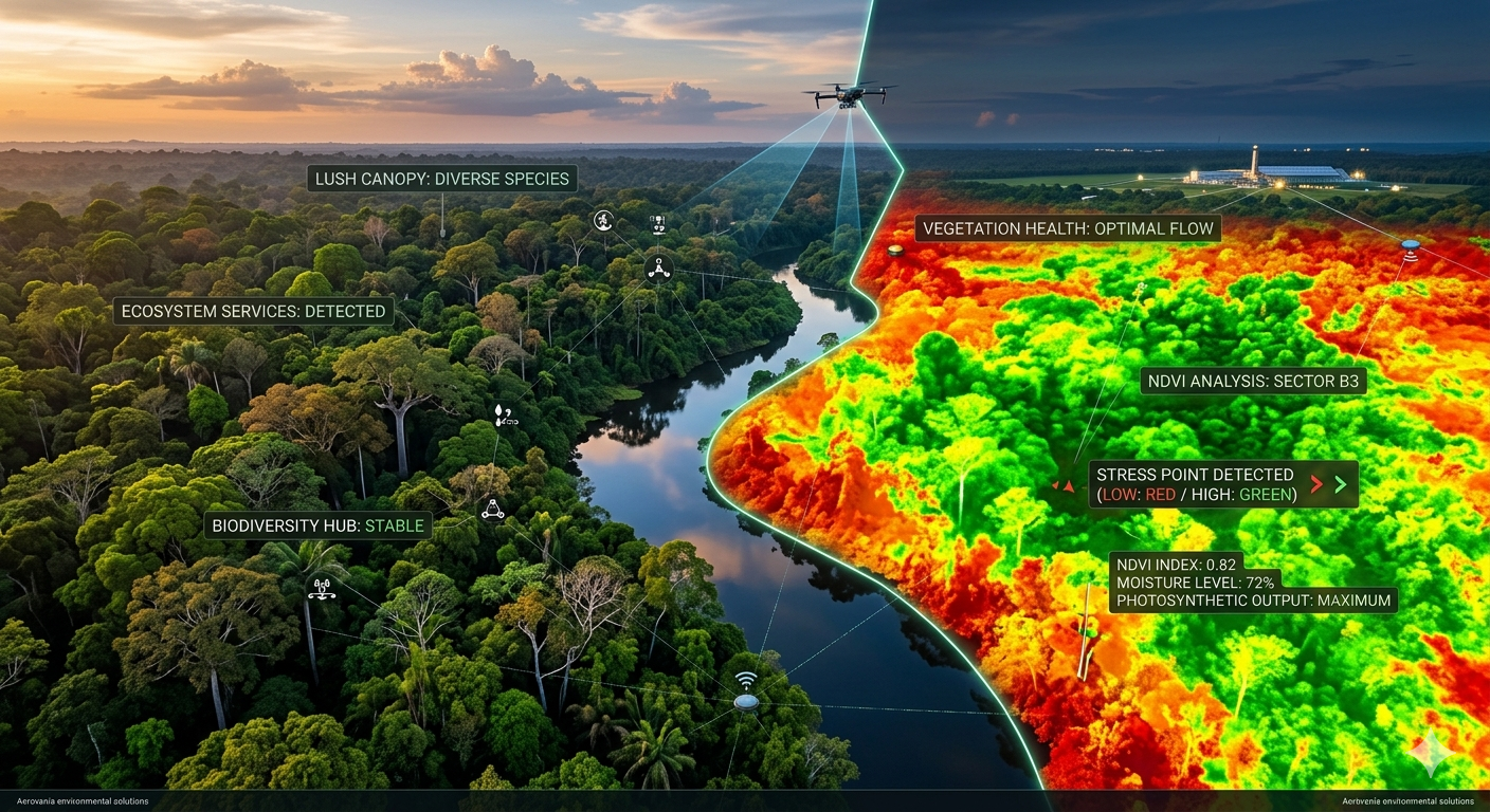
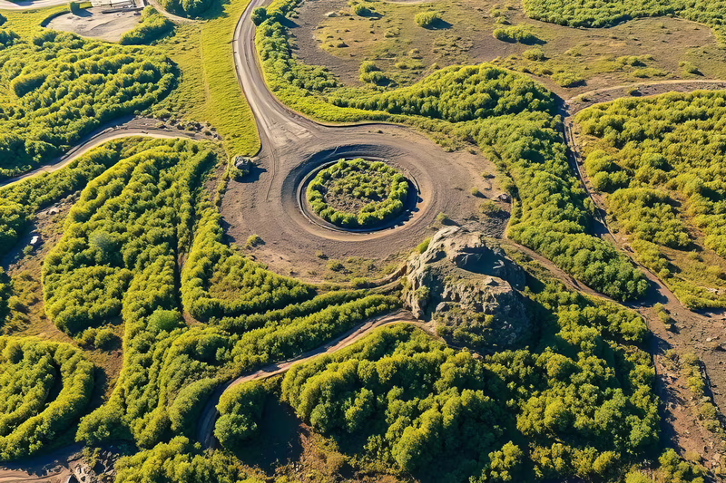
High-resolution multispectral drone surveys map vegetation cover, species distribution, and health indices across forest areas — providing accurate data for forest management and environmental impact assessments.
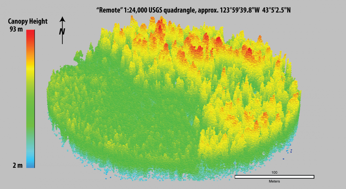
LiDAR point cloud surveys penetrate forest canopy to capture bare-earth terrain, tree height, canopy density, and biomass estimates — enabling detailed forest structure analysis without ground access.
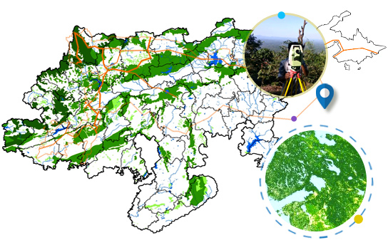
Drone surveys accurately delineate forest boundaries, detect encroachments, and map land-use changes along forest edges — providing legal-grade spatial data for forest departments and courts.
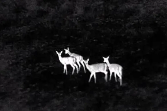
Thermal and multispectral drone surveys map wildlife habitats, water sources, and movement corridors — supporting conservation planning and environmental impact assessments for infrastructure projects.
Regular drone surveys monitor environmental compliance for mining, infrastructure, and industrial projects — detecting vegetation loss, water body encroachment, and land degradation for regulatory reporting.
Purpose-built for forest departments and environmental agencies.
LiDAR surveys penetrate dense forest canopy to capture bare-earth terrain and tree structure data unavailable from optical sensors.
Sub-5cm spatial accuracy for boundary delineation and encroachment detection meeting legal and regulatory standards.
Multispectral sensors capture vegetation health indices, species stress, and land cover changes invisible to standard cameras.
Machine learning models identify vegetation species, detect invasive plants, and classify land cover from drone imagery.
Automated compliance reports meet MoEFCC, forest department, and environmental tribunal documentation requirements.
Trusted by Maharashtra Forest Department and state environmental agencies for drone-based forest surveys.
Multispectral and LiDAR drones capture forest data at sub-5cm resolution.
LiDAR point clouds penetrate canopy to extract bare-earth and tree structure data.
AI models identify species, detect invasives, and classify land cover.
MoEFCC and forest department compliant reports delivered digitally.
Talk to our environmental mapping team about drone-based forest surveys and compliance monitoring.