Urban 3D mapping, infrastructure asset inventory, flood risk analysis, and smart city planning using high-resolution aerial surveys and AI-powered analysis.
Aerovania delivers drone-based 3D urban mapping, infrastructure asset inventories, and change detection for smart city projects — providing accurate spatial data for planning, monitoring, and management.
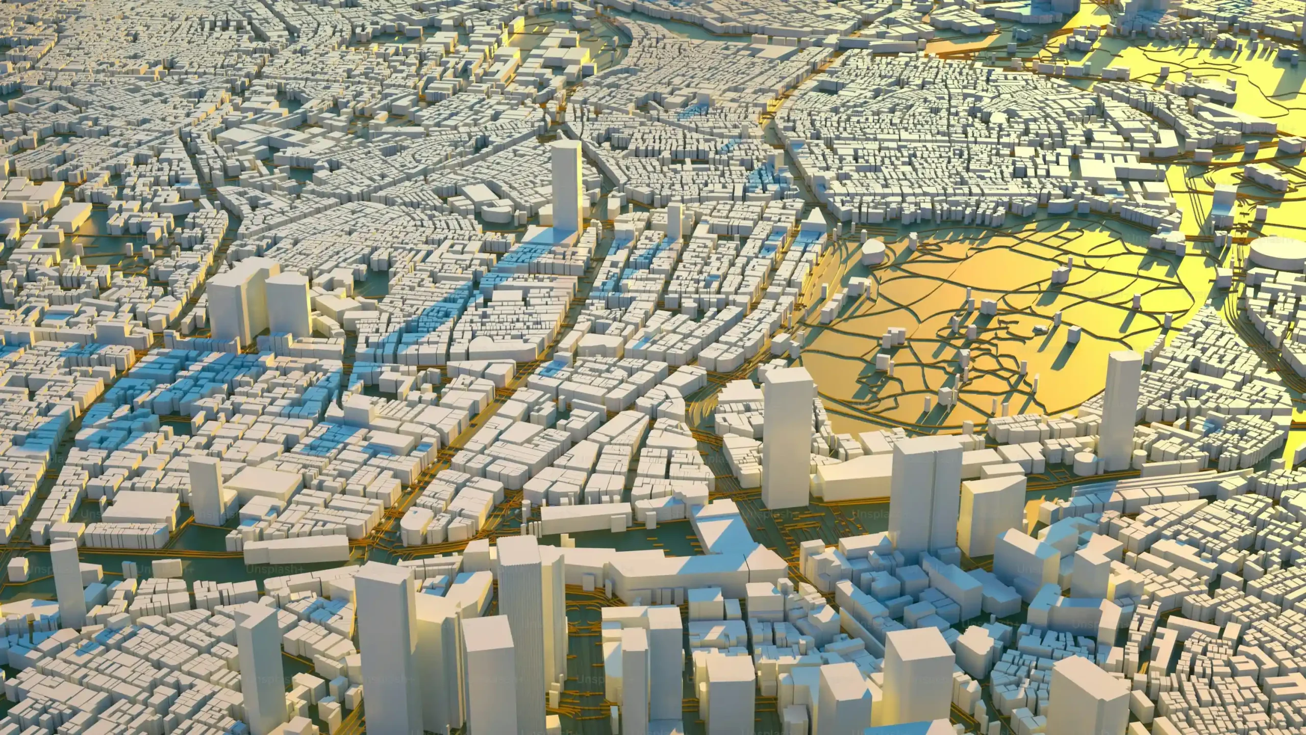
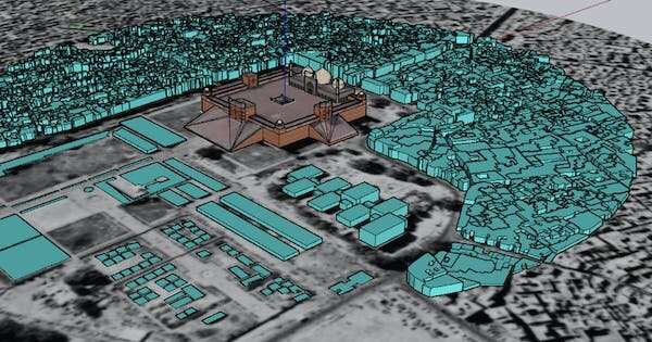
High-resolution drone surveys generate accurate 3D models of urban areas — capturing buildings, roads, utilities, and green spaces for city planning, development control, and smart city applications.
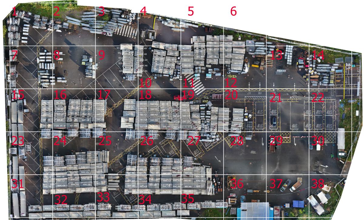
AI-powered drone surveys create comprehensive inventories of urban infrastructure assets — streetlights, signage, drains, footpaths, and utilities — with GPS coordinates and condition ratings.
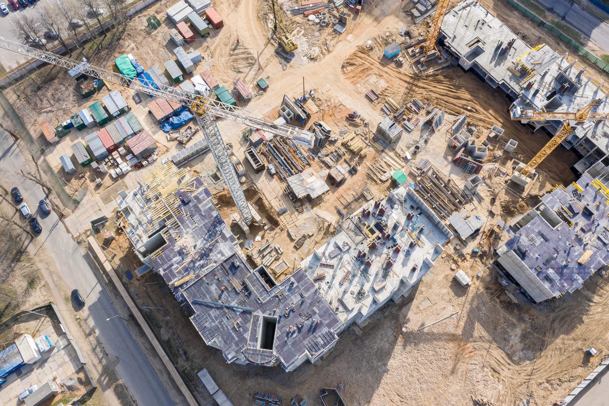
Regular drone surveys monitor urban construction projects — tracking progress, detecting encroachments, and ensuring compliance with approved plans for development control authorities.
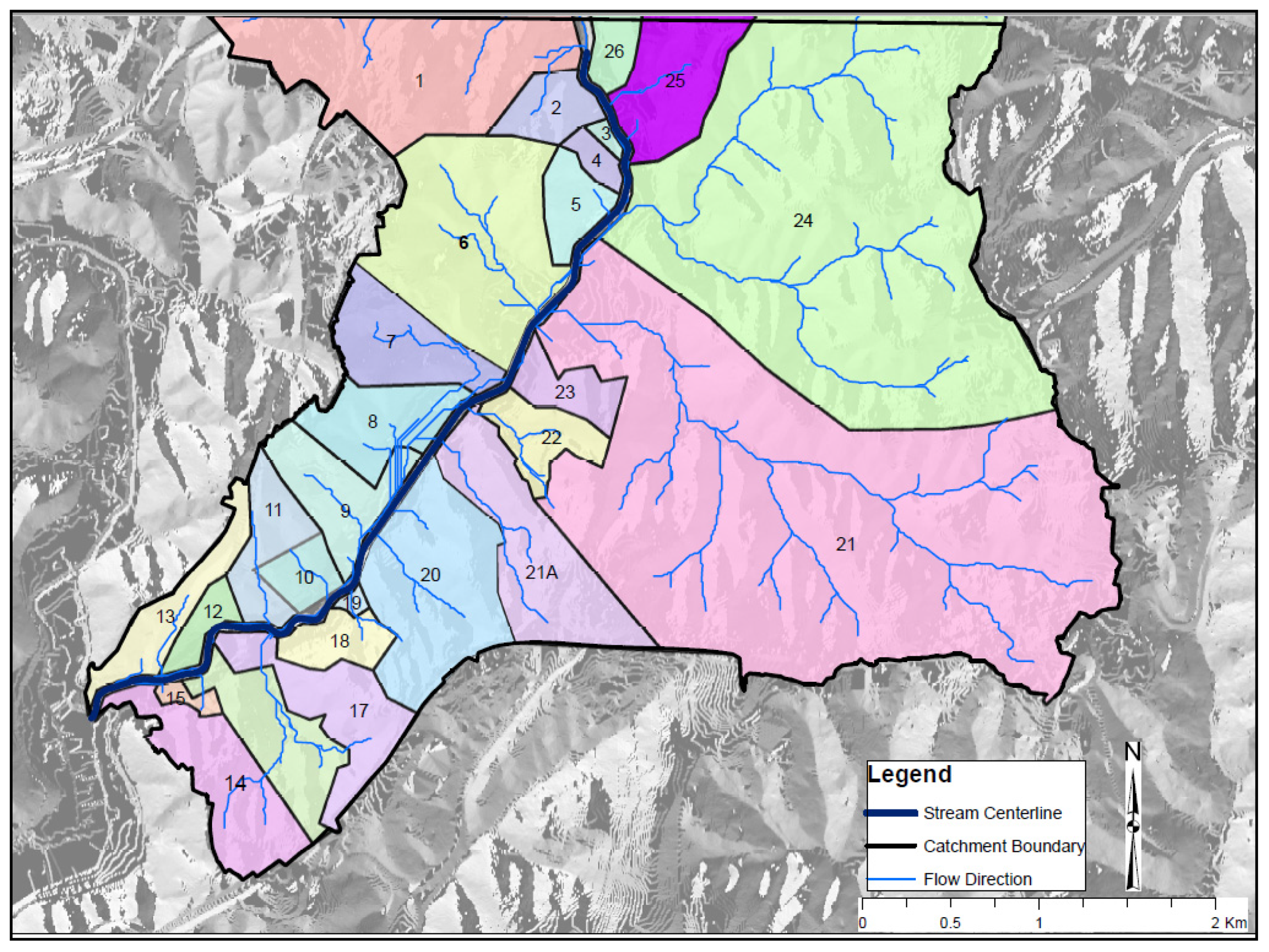
LiDAR-based terrain surveys map urban drainage networks, flood-prone areas, and stormwater flow paths — providing accurate data for flood risk assessment and drainage infrastructure planning.
High-resolution drone surveys document heritage structures, monuments, and tourism assets in 3D — creating accurate digital twins for conservation, restoration planning, and virtual tourism applications.
Purpose-built for urban local bodies and smart city authorities.
Accurate 3D models of entire urban areas generated from drone surveys for planning, development control, and smart city applications.
AI-powered detection and classification of urban infrastructure assets from drone imagery for comprehensive inventories.
LiDAR terrain surveys identify flood-prone areas, drainage bottlenecks, and stormwater flow paths for urban resilience planning.
Regular drone surveys track construction progress and detect encroachments for development control authorities.
All survey outputs integrate directly with GIS platforms, urban planning software, and smart city management systems.
Trusted by state PWDs, urban local bodies, and smart city authorities for drone-based urban mapping.
High-resolution drones capture the entire city in 3D at sub-5cm accuracy.
Point clouds generate accurate 3D city models for planning and management.
AI identifies and classifies urban assets, encroachments, and changes.
GIS-ready outputs integrate with planning and smart city management platforms.
Talk to our smart city team about drone-based urban mapping and infrastructure inventory solutions.