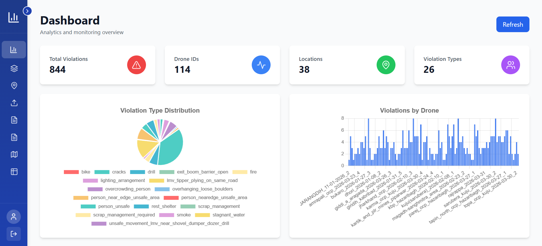
Get a complete operational picture with live KPIs, violation statistics, and time-series trend charts — all in one unified dashboard.
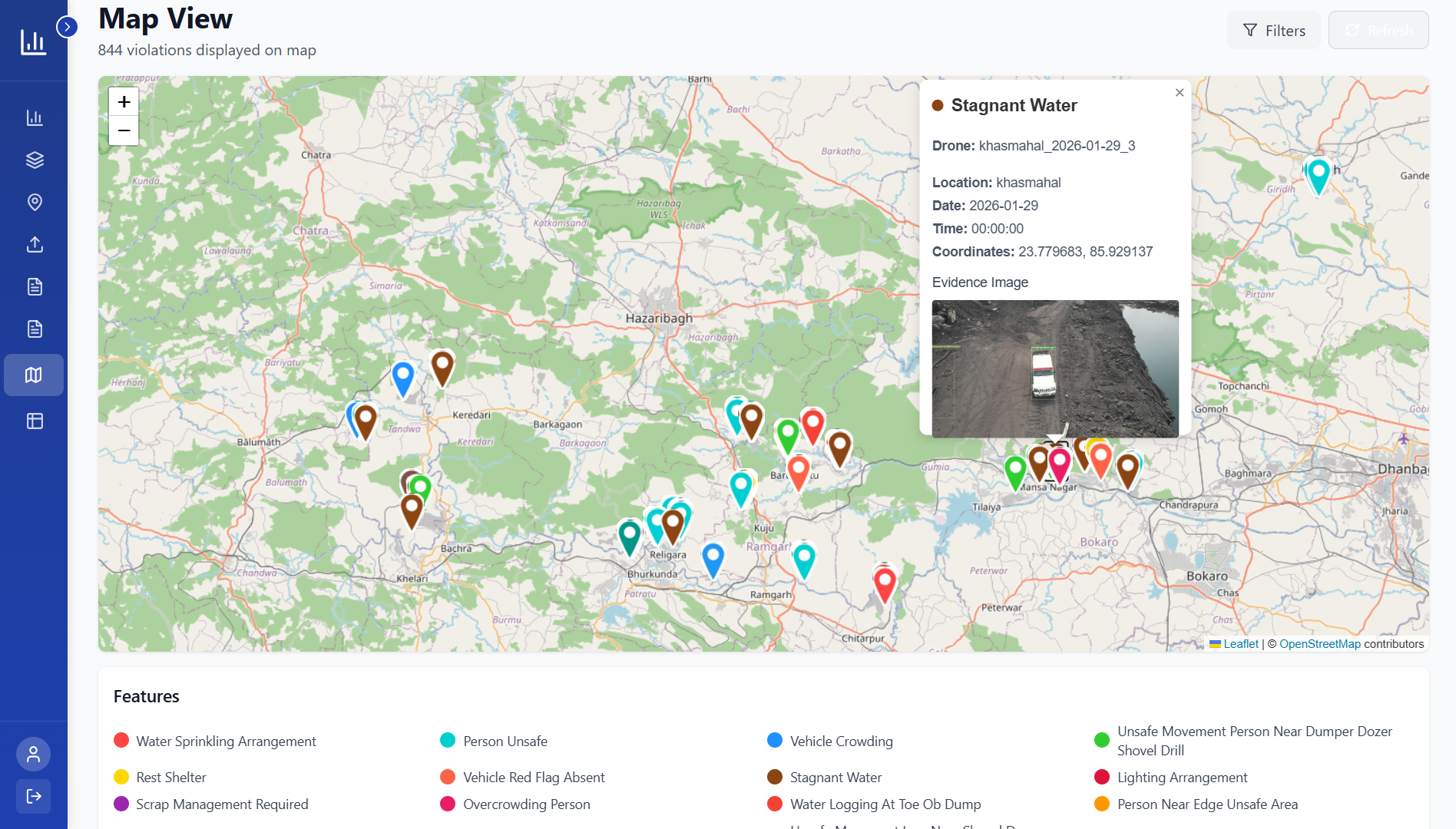
Violations are instantly plotted on an interactive geospatial map with custom markers so you can pinpoint incidents across all mine sites in real time.
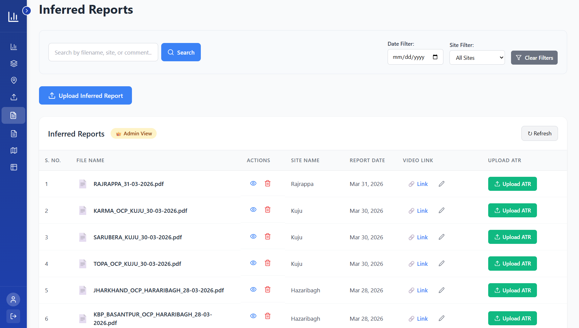
ATR (Accident/Incident Report) PDFs are stored securely on Cloudinary, organised by department with colour-coded badges and drag-and-drop upload.
Drones capture high-resolution imagery and video across the mine site, feeding data directly into the platform.
AI models process footage in real time ? detecting PPE non-compliance, restricted zone breaches, and safety hazards.
Violations are instantly plotted on the interactive map and reflected in KPI dashboards, tables, and trend charts.
ATR documents, violation exports, and compliance summaries generated and stored ? accessible by role and department.
Book a live demonstration and see how our AI aerial monitoring and analytics platform can transform your mine operations.
Book a Demo