Corridor surveys, track alignment, IWLARS wagon load analysis, bridge inspection and track condition assessment — zero track closures required.
Aerovania delivers LiDAR-powered corridor surveys, wagon load analysis, and AI-based track monitoring for Indian Railways — reducing inspection time and improving safety across thousands of kilometres of track.
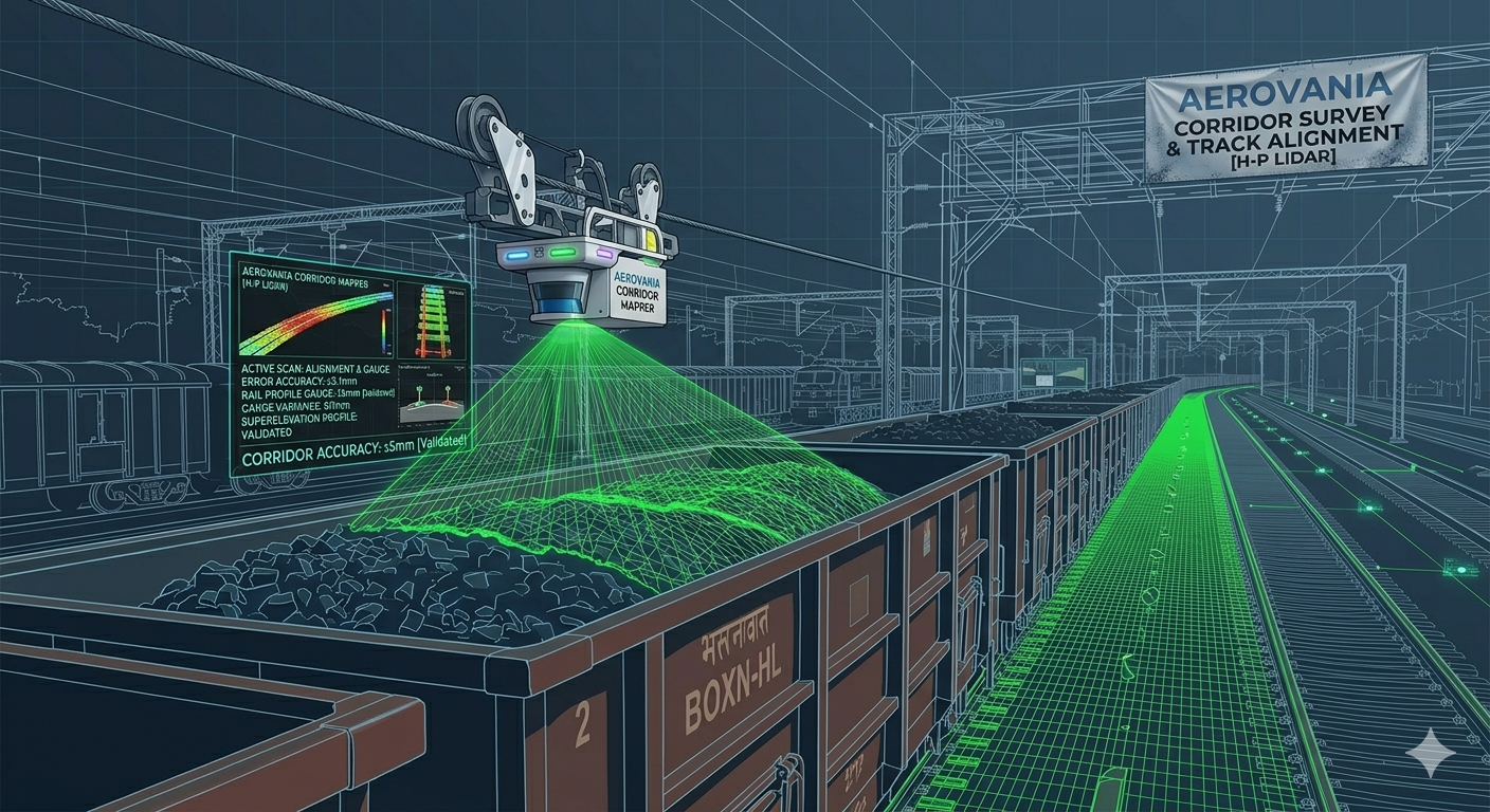
Pulley-guided LiDAR trolley system scans wagon loads in real time — generating 3D point clouds, weight distribution heatmaps, and derailment risk scores for every wagon before departure.
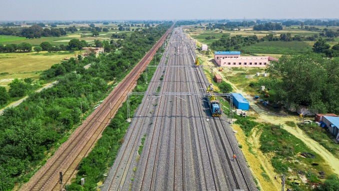
High-density LiDAR point cloud surveys of railway corridors capturing track geometry, clearances, and infrastructure assets with ±5mm accuracy across hundreds of kilometres in a single mission.
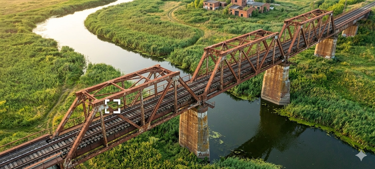
Drone-based visual and LiDAR inspection of railway bridges, culverts, and underpasses — detecting cracks, spalling, and structural deformation without track closures or scaffolding.
AI-powered analysis of track geometry data identifies rail defects, misalignments, and wear patterns — enabling predictive maintenance scheduling before failures occur.
Drone surveys map the full railway right-of-way, detecting encroachments, vegetation overgrowth, and boundary violations along the corridor for proactive management.
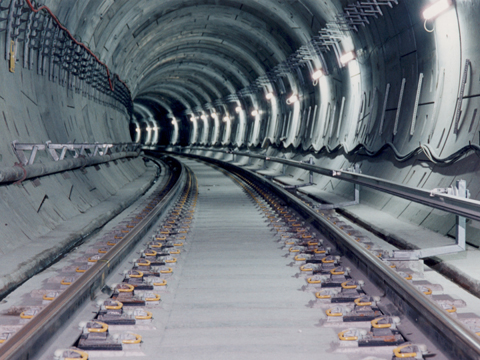
LiDAR-equipped drones perform full interior scans of railway tunnels — capturing wall profiles, lining deformation, crack mapping, and clearance measurements without halting train operations or deploying inspection teams into confined spaces.
Purpose-built for Indian Railways — not adapted from general survey tools.
±5mm corridor accuracy across LiDAR surveys meeting the precision demands of Indian Railways track geometry and clearance standards.
Drone and trolley-based surveys operate without track possession — no disruption to train operations or scheduling.
Purpose-built pulley-guided LiDAR trolley for wagon load analysis — the only system of its kind for Indian Railways.
Machine learning models detect track defects, misalignments, and wear patterns from survey data automatically.
Automated survey reports meet Indian Railways inspection and compliance documentation requirements.
Operational capability across all Indian Railways zones — from mountain corridors to coastal mainlines.
LiDAR surveys map the full railway corridor at ±5mm accuracy.
Pulley-guided LiDAR trolley scans wagon loads generating stability reports.
Drones inspect bridges and culverts detecting cracks and spalling.
Indian Railways compliant survey and inspection reports delivered instantly.
Talk to our railway intelligence team about LiDAR corridor surveys and IWLARS wagon analysis.