A unified, end-to-end architecture from drone hardware and multi-sensor payloads to AI processing pipelines, cloud infrastructure, and GIS-ready intelligence delivery.
Aerovania's system architecture connects every component from sensor acquisition to intelligence delivery in a tightly integrated, field-proven stack. Each layer is purpose-built, not adapted from consumer technology.
Explore each layer of Aerovania's integrated architecture from data acquisition to final intelligence delivery.
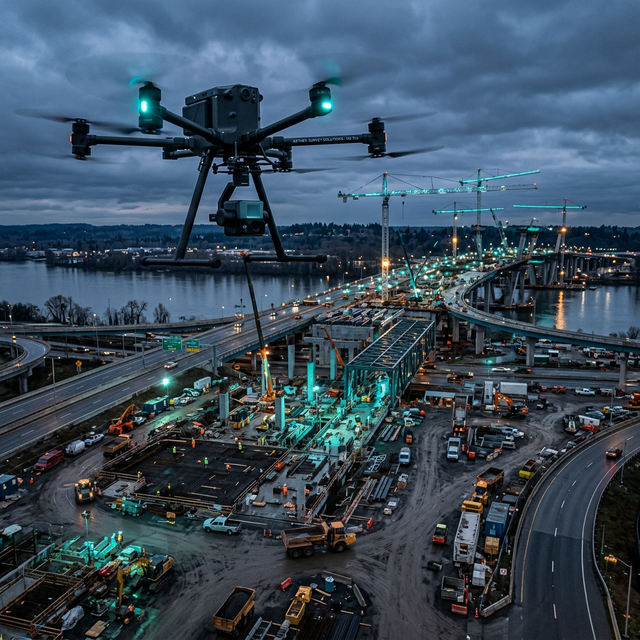
Purpose-built drone platforms carry modular sensor payloads LiDAR, RGB, multispectral, thermal, and hyperspectral matched to each mission profile and operating environment.
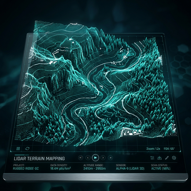
Raw sensor data flows through a multi-stage pipeline photogrammetry, point cloud fusion, orthorectification, and data calibration producing verified, analysis-ready outputs at scale.
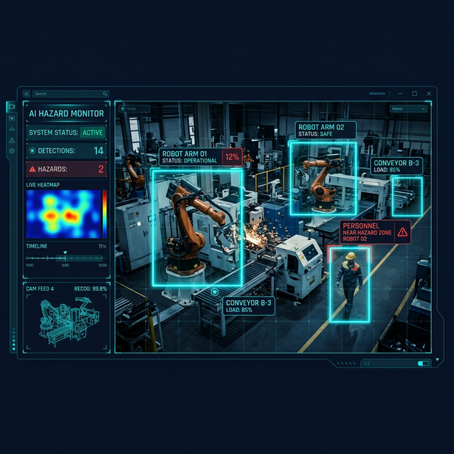
Computer vision models, change detection algorithms, and predictive analytics extract actionable intelligence from processed data running on-device for real-time results or at cloud scale for large datasets.
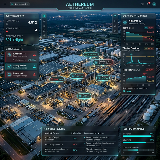
Processed intelligence is delivered as GIS-ready files, web dashboards, API feeds, or custom client portals integrated directly into your existing workflows and systems.
Every layer is engineered for reliability, accuracy, and integration not just theoretical performance.
All four layers are designed to work together seamlessly no data loss, no format conversion headaches between systems.
Edge compute handles critical processing in the field. No internet dependency for time-sensitive operations.
From a single drone survey to a multi-UAV fleet operation the architecture scales without redesign.
REST APIs and standard GIS formats ensure compatibility with your existing GIS platforms, ERP, and C2 systems.
All data is encrypted in transit and at rest. On-premise deployment options available for classified operations.
2cm end-to-end accuracy from sensor to final deliverable validated across hundreds of real-world deployments.
Request a technical briefing on Aerovania's end-to-end system architecture for your use case.
Request a Briefing